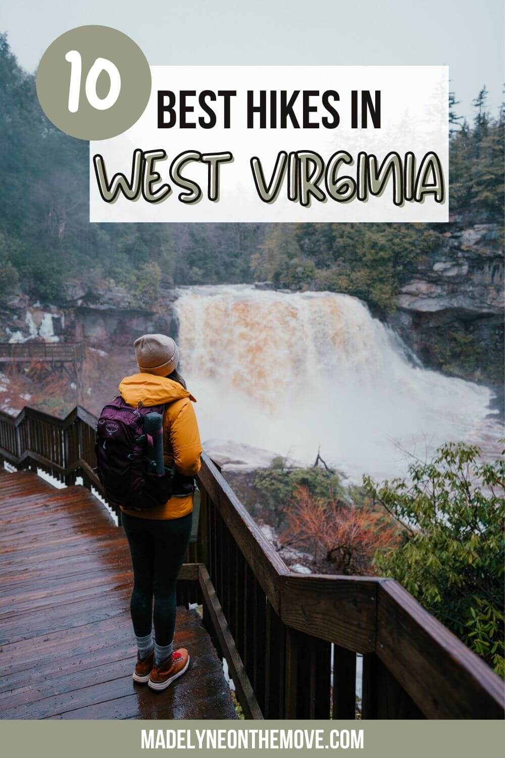
The 10 Best Hikes in West Virginia
Planning a trip to West Virginia, but in need of some guidance when it comes to hiking? Maybe you’ve done a bit of adventuring in this incredible state and are looking for new spots to explore, or maybe this is your first time visiting and you don’t know where to start — either way, you’re in the right place!
In this post, I’m sharing 10 of the best hikes in West Virginia. I’ve included hikes from easy nature walks to total thigh burners in order from easiest to most difficult.
By the way, you’re going to want to save this for reference if you plan to hike in WV with dogs — every trail on this list is dog-friendly!

Can’t-Miss Hikes in West Virginia
Please remember to Leave No Trace when recreating outdoors so we can enjoy the best hikes in West Virginia for years to come! Also, don’t forget to carry the Ten Essentials on your hike. Click here to see my full list of hiking essentials.
Open the best hikes in West Virginia in Google Maps!
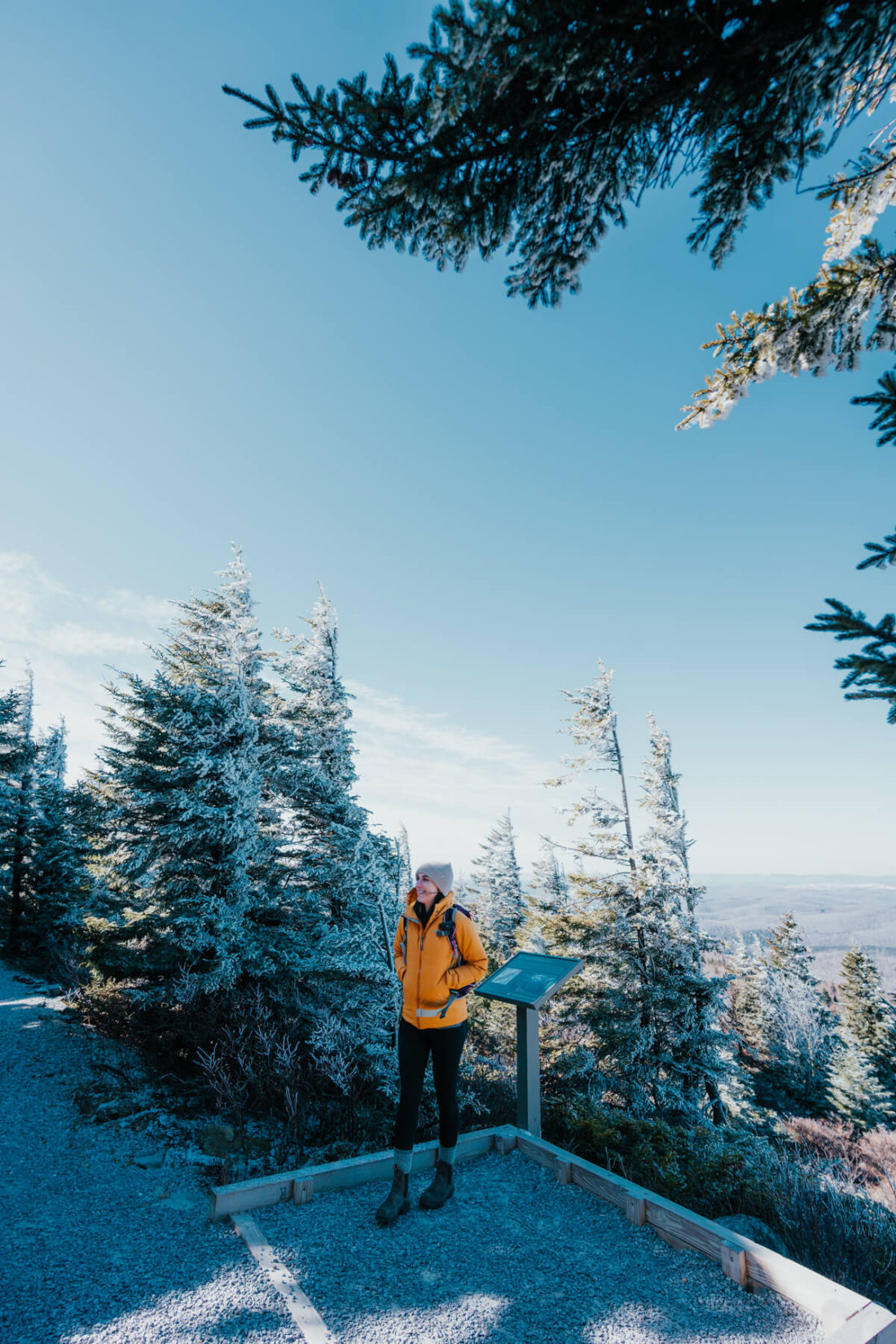
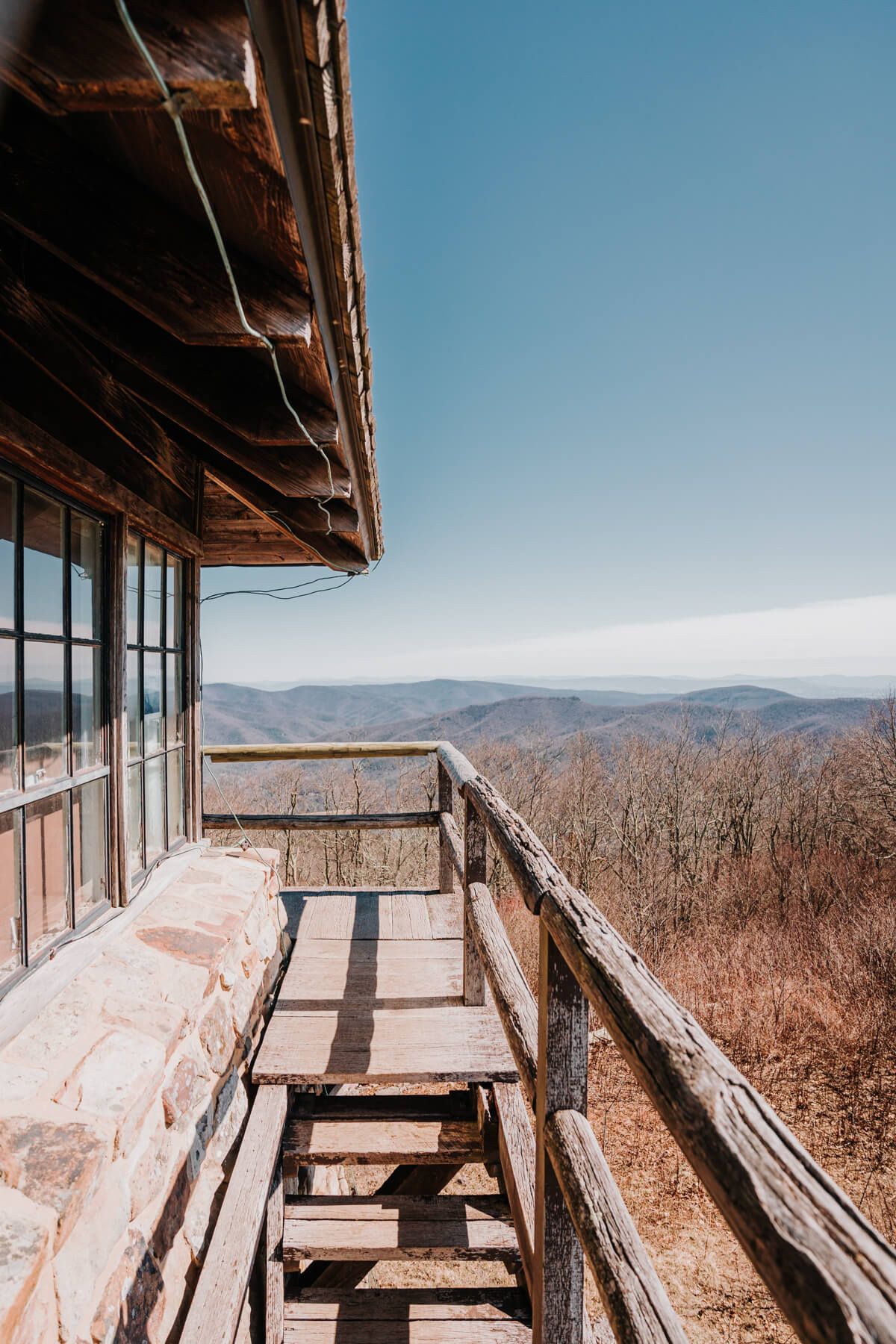
Spruce Knob
- Distance: 0.6mi loop
- Difficulty: Easy
- Pet-friendly: Yes
- Kid-friendly: Yes
- Get directions
Fun Fact: Spruce Knob is the highest point in WV. The views from this breezy, kid-friendly hike are stunning!
At just 0.6mi with virtually no elevation gain, this “hike” is arguably more of a nature walk. While I might not go out of my way to do this one (solely due to its short length), you should definitely add it to your list if you’re in the area.
At the trailhead, you’ll immediately step into a dense spruce forest. This path leads you to an observation tower a few minutes into the hike. Stop here to take in the sweeping views of the Allegheny Mountains in the distance. The Allegheny Mountains are part of the Appalachian Mountain range (as are the Blue Ridge Mountains). You’ll find various lookout points and even some signage providing more information about this area throughout the short loop.
Need a place to stay while adventuring in WV? Check out Spruce Mountain Cabins — they have a variety of options ranging from glamping tents to cozy cabins.
Lindy Point
- Distance: 0.8mi out & back
- Difficulty: Easy
- Pet-friendly: Yes
- Kid-friendly: Yes
- Get directions
First and foremost: I HIGHLY recommend that you download offline maps for navigating to this trailhead! It’s tucked deep in Blackwater Falls State Park, and I lost service on the way out there.
Lindy Point is a short and easy hike through rhododendrons that leads you to breathtaking views of Blackwater Canyon. I couldn’t believe my eyes when we made it to the overlook platform. I wasn’t sure what to expect, but I underestimated the vastness of this canyon — it’s incredible! I can only imagine what this place looks like during peak fall colors.
This trail is flat but was rather muddy (despite it not having rained recently), so I recommend wearing a good pair of hiking boots!
Pro tip: Stop by Lindy Point for sunset after visiting Blackwater Falls. Afterwards, head to Thomas, WV for dinner. It’s a 10 minute drive from Blackwater Falls State Park and a lot less crowded than Davis, WV. You can’t go wrong with either Farm Up Table (best chicken sandwich I’ve EVER eaten) or Riverfront Wood Fired Pizza (10/10 would recommend the BBQ chicken pizza).
Read More: Planning a WV Winter Getaway
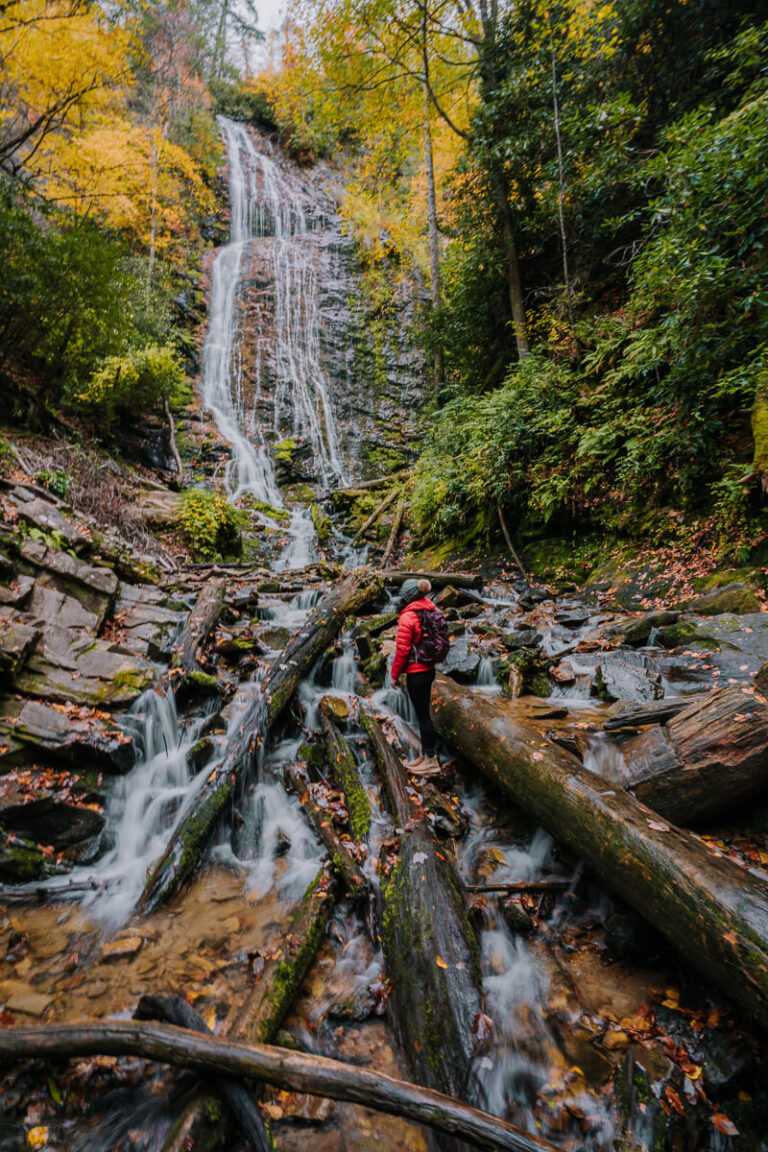
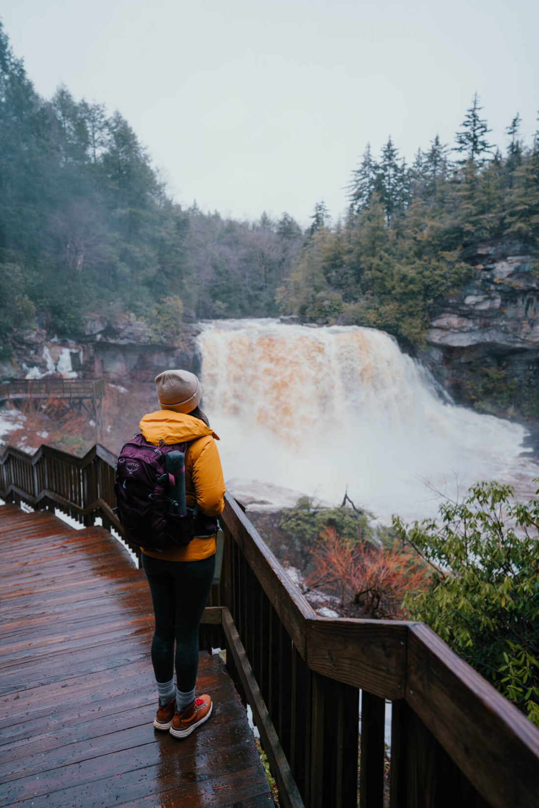
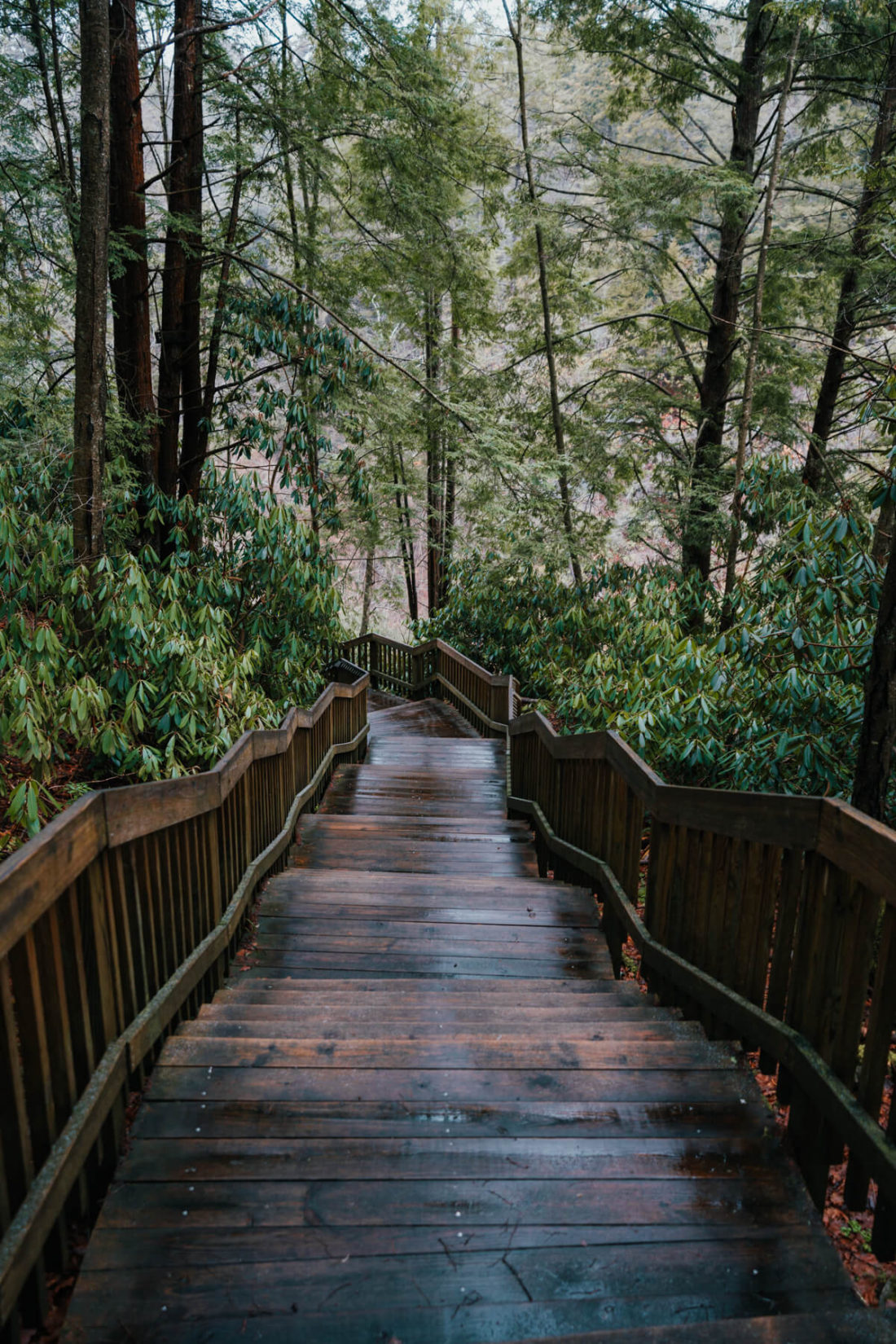
Blackwater Falls
- Distance: 0.4mi out & back
- Difficulty: Easy
- Pet-friendly: Yes
- Kid-friendly: Yes
- Get directions
There’s no shortage of hiking trails in West Virginia with waterfalls! Blackwater Falls is one of my favorites — not just because of the waterfall itself, but also because of the lush, mossy forest you walk through to get to the waterfall. I’m a sucker for anything with PNW vibes, especially in the dead of winter when everything is brown in the Southeast.
A few trails within Blackwater Falls State Park offer views of this 57-ft beauty. The one I’m referring to in this post is named the Blackwater Falls Boardwalk Trail and starts at the Trading Post.
The trail involves a lot of stairs despite its short length. However, don’t let that deter you. The stairs are gradual and there are spots to stop along the way if needed. Once you get to the waterfall, you might notice that it has a distinct reddish/orange tint. According to WV State Parks, the waterfall is “tinted by the tannic acid of fallen hemlock and red spruce needles.”
FYI – Pack EXOspikes if you visit during wintertime to err on the side of caution. Snow and ice get packed down on the boardwalk, and it gets slippery!
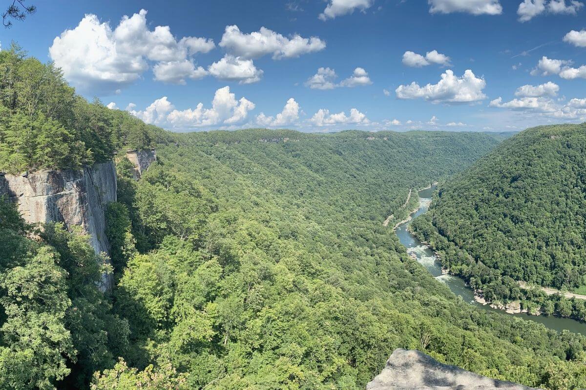
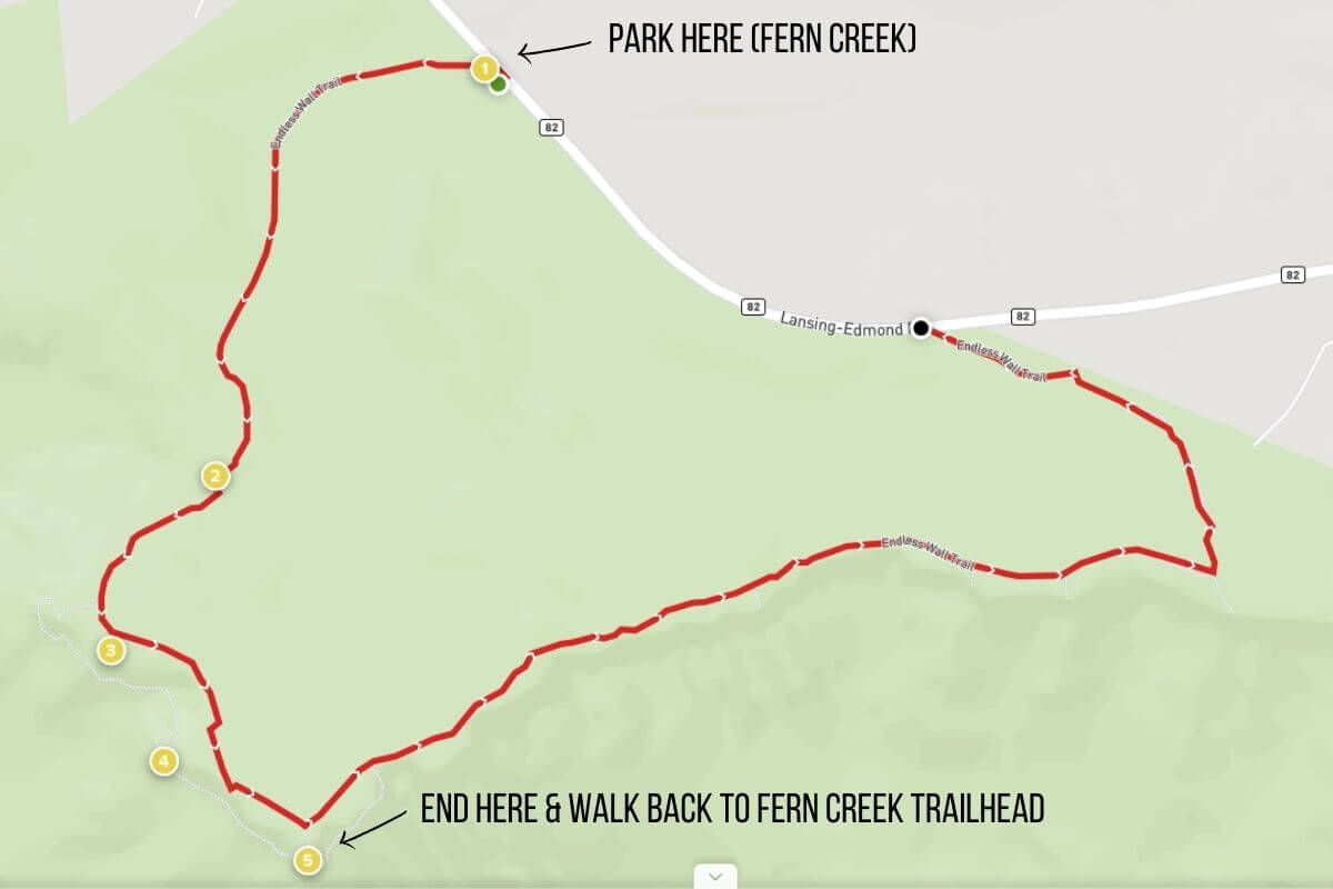
Endless Wall Trail
- Distance: 2.0mi out & back (from Fern Creek trailhead to Diamond Point & back)
- Difficulty: Easy
- Pet-friendly: Yes
- Kid-friendly: Yes
- Get directions
Endless Wall Trail is one of the most rewarding easy hikes in West Virginia. The trail itself is a lot of fun and offers the most incredible views of the gorge and the 2nd oldest river in the world.
I’m a big fan of hikes with epic views throughout as opposed to one endpoint with views. If you’re the same way, you’ll love this one. My advice? Do this hike and Long Point Trail (next on the list) while visiting New River Gorge National Park and Preserve. Whereas this trail gives you an unparalleled peek inside the gorge, Long Point offers the best views of the bridge.
This trail can be done as out & back OR a loop. There are two trailheads: Nuttall and Fern Creek. I recommend parking at Fern Creek and doing this as an out & back hike by turning around at Diamond Point. Doing so prevents you from having to walk alongside the road to get back to your car at the end. Also, the latter half of the hike (that you’ll be skipping) isn’t as scenic.
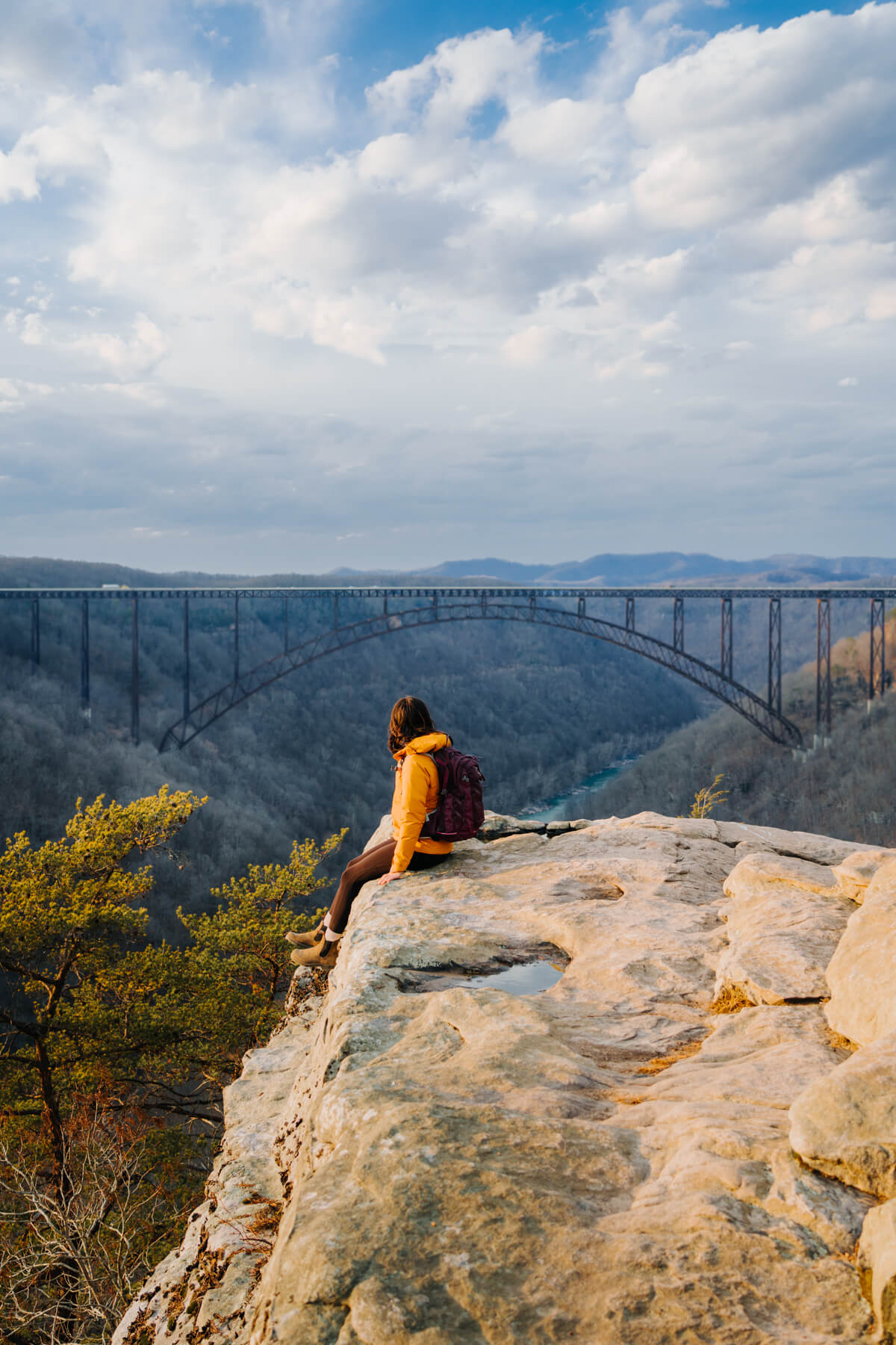
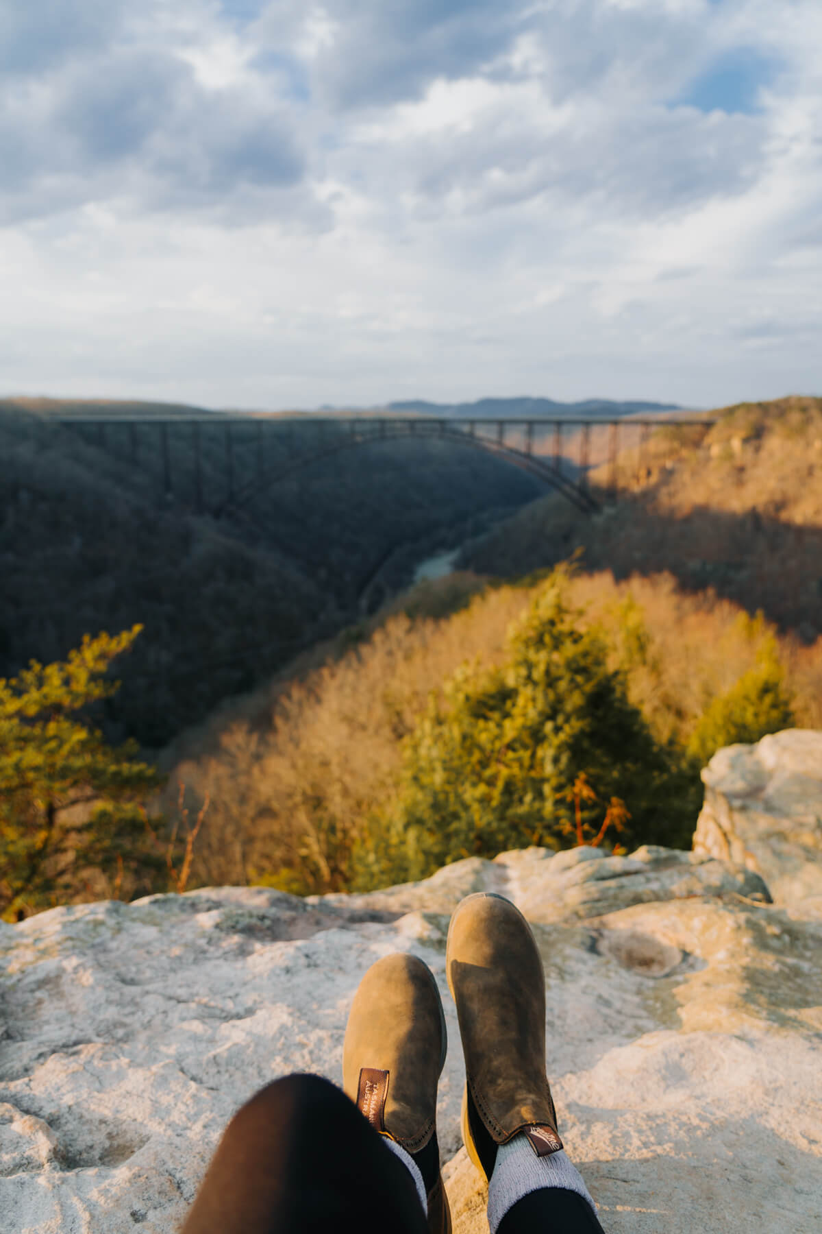
Long Point Trail
- Distance: 3.0mi out & back
- Difficulty: Moderate
- Pet-friendly: Yes
- Kid-friendly: Yes
- Get directions
If you’re planning to visit America’s newest national park, New River Gorge National Park and Preserve, you must hike Long Point Trail. It’s one thing to drive across the New River Gorge Bridge, but seeing it from this angle gives you a whole new appreciation for its grandeur. The cars look like ants on the bridge in the distance!
I think it’s worth mentioning that I was not 100% convinced I was in the right place when I arrived at the trailhead. There’s a designated parking area, but it’s on a residential street. Thankfully, there are “Long Point Trail” signs to reassure you and point you in the right direction. Once you get going, look out for signage throughout the hike that explains more about the history of the gorge!
This trail is easy for the most part with a few “moderate” slopes. I recommend downloading the trail for offline navigation on AllTrails, because there are multiple forks and it can get confusing in some spots. You must have a Pro membership to do so, but I promise it’s worth the money ($29.99/year). When you’re nearing the end, you’ll walk through a rhododendron tunnel before reaching the rock outcropping from which you can see the bridge.
Read More: Are Blundstones Good for Hiking?
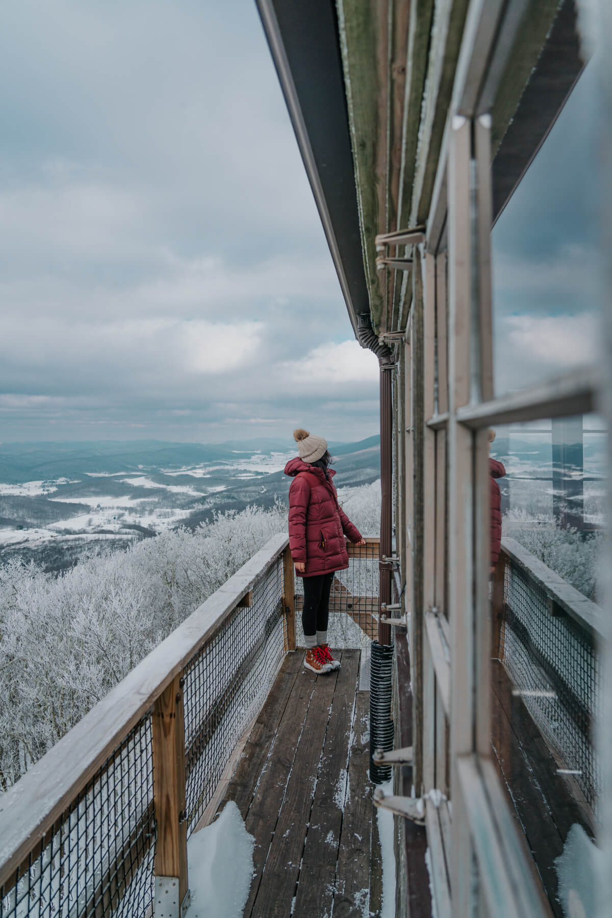
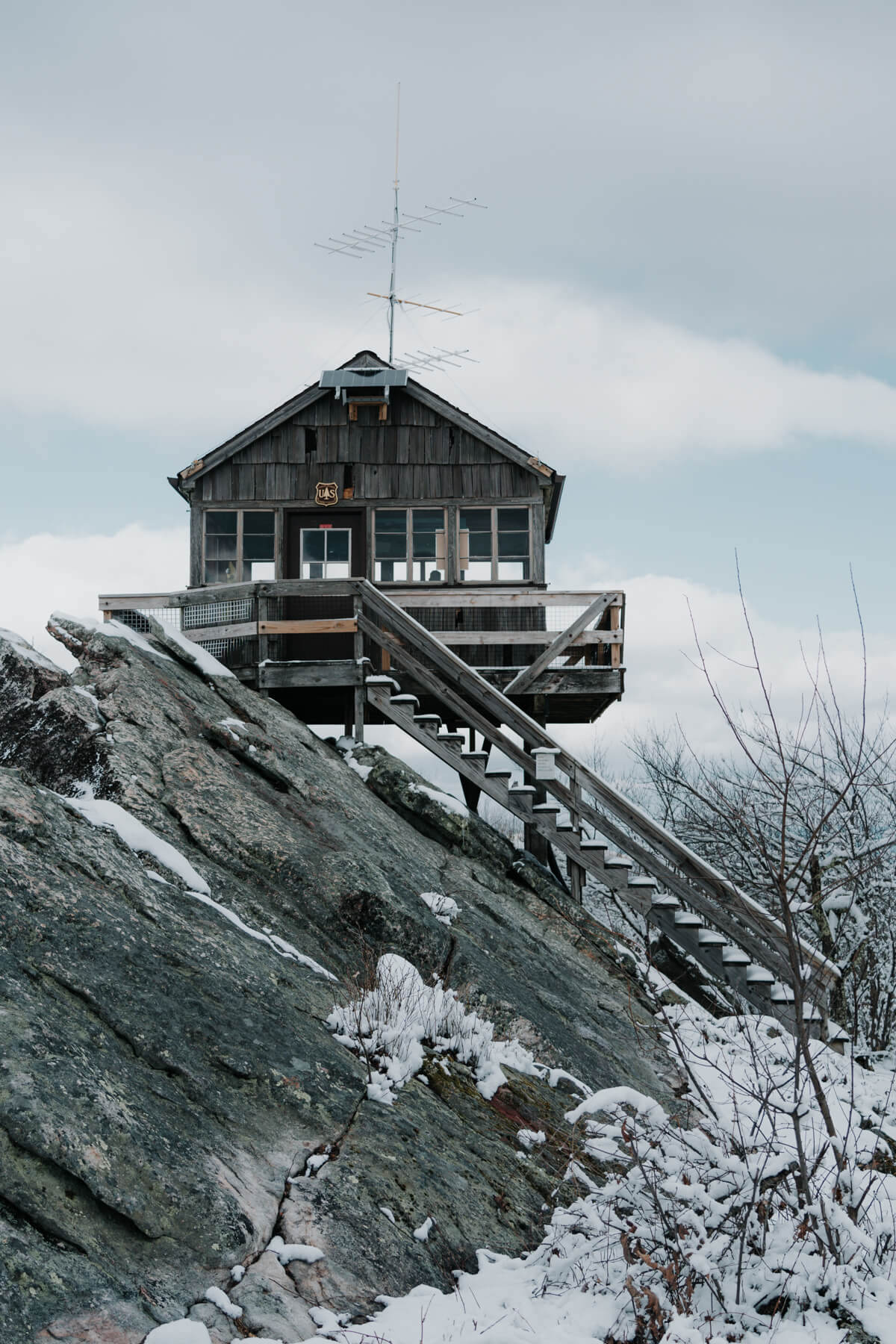
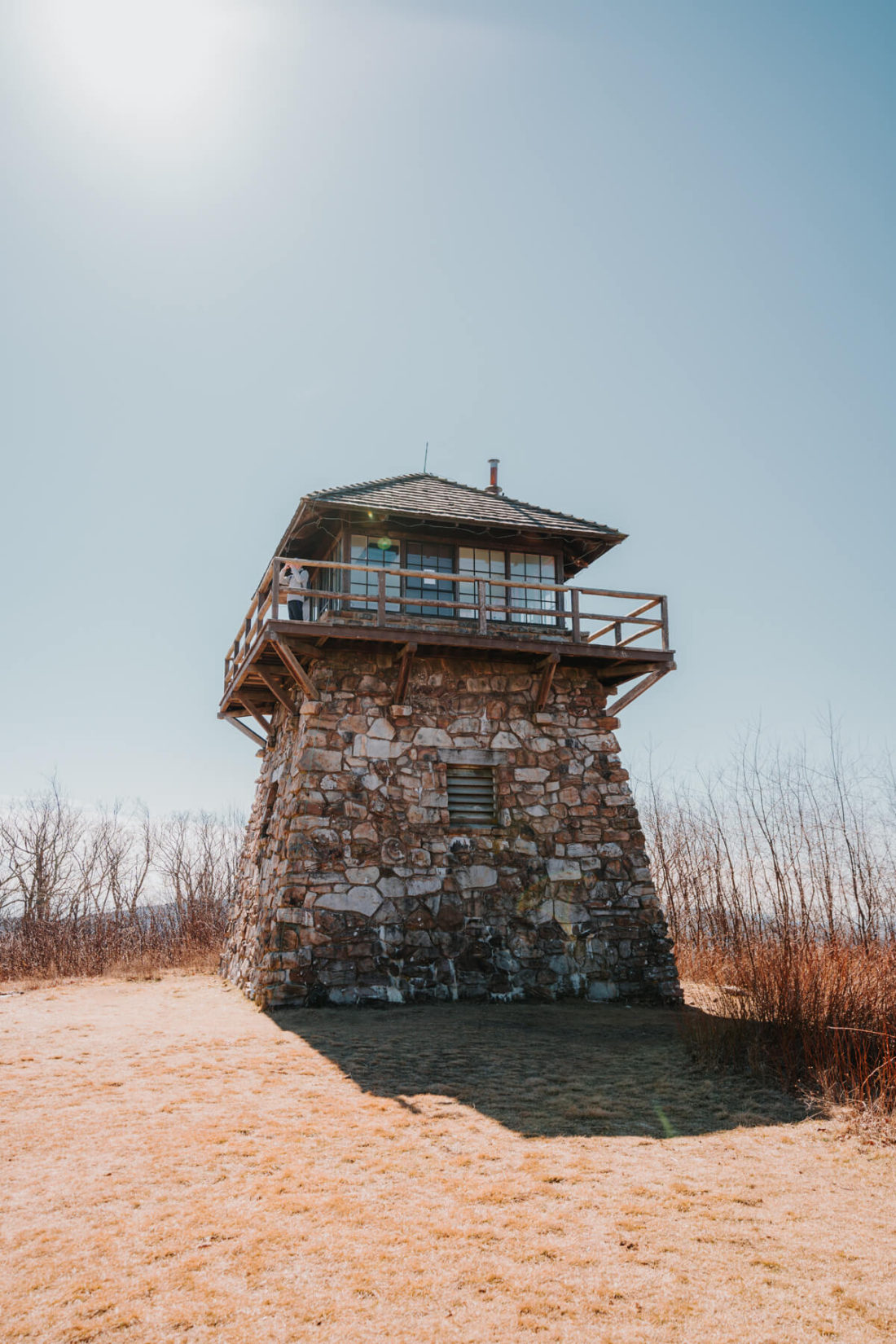
Hanging Rock Raptor Observatory
- Distance: 2.1mi out & back
- Difficulty: Moderate
- Pet-friendly: Yes
- Kid-friendly: Yes
- Get directions
If I had to pick a favorite hike on this list, I think it would be this one! I’d argue that Hanging Rock Raptor Observatory offers some of the best views in WV. What’s not to love about a lookout with panoramic mountain views?
This picturesque lookout tower is situated right on the WV/VA border, making it the perfect spot for a day trip from Roanoke or Blacksburg. If you want to spend the day adventuring, stop by Cascades Falls in VA before or after your hike to the lookout.
The drive to get to the trailhead is beautiful in and of itself — I was even able to spot the observatory on top of the mountain as we were driving up! Now, what’s it like hiking to the lookout (if you don’t do it in several inches of fresh powder without extra traction for your boots, which you left in your car because you thought you wouldn’t need it)… that may or may not have made this hike far more challenging for me than it truly is. There are steep sections at the beginning and end of the trail, but it’s mostly a gradual walk through the forest aside from that.
Hang out in/around the observatory once you make it to the top. There are benches inside, which are perfect for bird watching. If you’re lucky, you might see some migratory birds passing through.
High Knob Tower
- Distance: 2.7mi out & back
- Difficulty: Moderate
- Pet-friendly: Yes
- Kid-friendly: Yes
- Get directions
Have you ever crossed state lines on a hike? To get to this charming lookout tower in the George Washington and Jefferson National Forests, you’ll start in West Virginia and end in Virginia. A friend and I stopped to do this hike on our way back to NC from WV. We both agreed we’ll be back to do this one again in the future.
Finding the trailhead from the parking lot can be tricky because it’s not readily visible due to the steep descent. I recommend locating the sign/map at the far end of the parking area and then walking left. Look over your right shoulder, and you should see the trail.
Overall, it’s a nice, moderate hike — you’ll probably work up a sweat, but it’s not an all-day endeavor. Remember that 360-degree mountain views are waiting for you at the top, and you’ll be golden. I would expect to spend a few hours on this trail at most. There are several steep and rocky sections throughout this hike, so I recommend trekking poles for added stability.
By the way, Harrisonburg, VA is a super cute town to stop in for lunch or coffee before or after your hike.
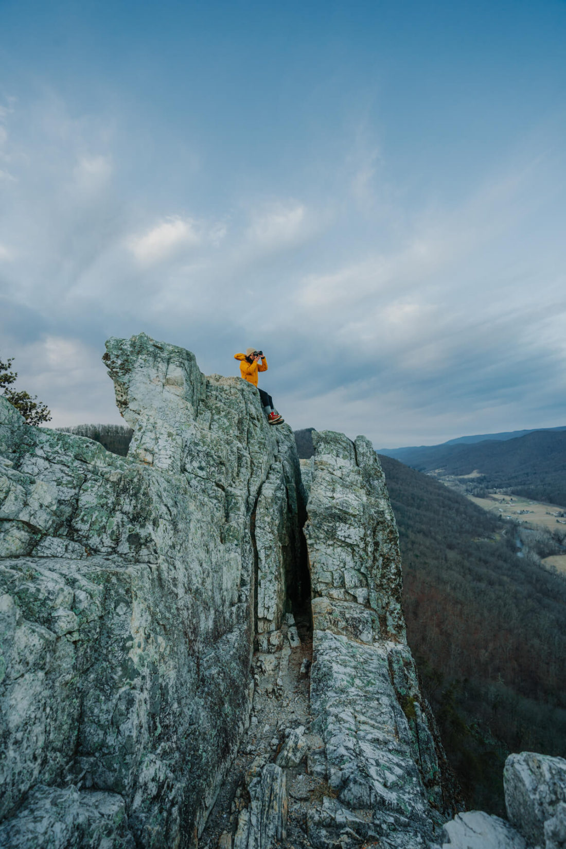
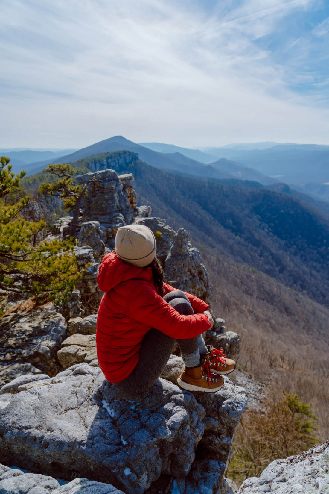
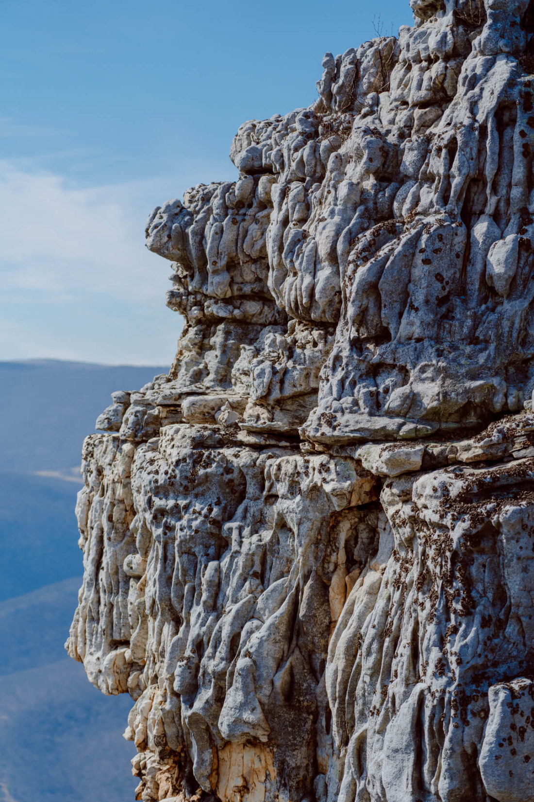
Seneca Rocks
- Distance: 3.6mi out & back
- Difficulty: Moderate
- Pet-friendly: Yes
- Kid-friendly: Depends
- Get directions
Seneca Rocks is one of the most unique hikes in the Southeast. The giant rock formation reminds me of Custer State Park in South Dakota — not something I would expect to see in West Virginia. This hike was on my list for YEARS before I finally made it there, and I’m happy to report that it surpassed my expectations.
This isn’t a hidden gem by any means, so expect to share the trail, especially on weekends or during leaf-peeping season. My friend and I lucked out and had the trail to ourselves on our sunrise hike in February, but we did brave some brutal cold and wind in return. Do this hike on a weekday if you can swing it.
The scenery is epic, but you have to work for it! You can see the rock formation in plain view at the very beginning of the hike, so you’ll quickly get an idea of the level of thigh burning that’s about to ensue. Fortunately, the trail was designed with switchbacks to make the ascent more gradual. I’d say it’s very doable for the average person so long as you take breaks as needed.
A quick note on whether this hike is pet/kid-friendly: If you have your heart set on walking out onto/across the rocks, know that it involves rock scrambling at the end. Not to mention the fact that you’re 900ft up with no railing of any sort. HOWEVER, there is an observation platform right before the rock scramble, and I would consider this hike pet/kid-friendly if you stop there!
Maryland Heights

- Distance: 4.5mi out & back
- Difficulty: Moderate
- Pet-friendly: Yes
- Kid-friendly: Yes
- Get directions
Maryland Heights is one of the best hikes in West Virginia for a day trip from DC! There are lots of things to do in Harpers Ferry ranging from visiting the historic town to exploring the 20+ miles of hiking trails. The Maryland Heights Trail takes you to an overlook with an incredible view of downtown Harpers Ferry.
Start early (or go on a weekday) if possible since this is a heavily trafficked trail. The parking situation can be a pain. I recommend parking at the Visitors Center ($20/vehicle) and then taking the shuttle to the trailhead.
Expect a rather aggressive uphill climb on the way up. Fortunately, this means the trek back is downhill! The hike will most likely take anywhere from 3-4 hours, so it’s the perfect way to spend your morning before checking out more of Harpers Ferry later in the day.
North Fork Mountain Trail to Chimney Top
- Distance: 5.3mi out & back
- Difficulty: Hard
- Pet-friendly: Yes
- Kid-friendly: Depends
- Get directions
Looking for a challenge? North Fork Mountain Trail to Chimney Top is one of the best day hikes in WV (as long as you’re prepared to work up a sweat). Some of us are gluttons for punishment, eh? Wear good hiking shoes, pack lots of water, take breaks as needed, and you’ll knock this one out of the park.
Parking for this hike is limited, so I recommend getting an early start. It’s not as popular as some of the other hikes on this list, but this is a well-known area for hikers and campers. I recommend packing a picnic lunch if you want to kick back and enjoy the views from the top for a while! You could also find a spot with great views to set up a hammock.
You’ll alternate between steep sections and flat spurts throughout this hike. This gives you the opportunity to catch your breath here and there. The last quarter mile is the steepest section by far. I recommend trekking poles for added stability!
Also, the trail becomes difficult to navigate towards the top, so I recommend downloading the trail for offline navigation on AllTrails. You must have a Pro membership to do so, but I promise it’s worth the money ($29.99/year).
And there you have it — the best hikes in West Virginia! Do you have a favorite hike in West Virginia? A few more spots on my (ever-growing) list include Dolly Sods Wilderness and Coopers Rock State Forest. Let me know if there are other spots I need to add!